

Snoqualmie Pass Webcam : Live I-90 Traffic & Weather Updates
Mountain weather is notoriously unpredictable. One moment, you are driving under clear, sunny skies in Seattle; the next, you are navigating through a blinding snowstorm in the Cascade Mountains. For thousands of commuters, truck drivers, and outdoor enthusiasts traveling along Interstate 90 (I-90), checking the Snoqualmie Pass webcam system is a mandatory step before hitting the road.
Visual confirmation of road conditions is far more reliable than a generic weather forecast. Live traffic cameras show you exactly what is happening on the pavement right now. Whether you are hauling commercial freight, heading up for a weekend of skiing, or simply crossing the state to visit family, understanding how to read and utilize these live feeds can save you time, prevent damage to your vehicle, and ultimately keep you safe.
This comprehensive guide will break down everything you need to know about navigating Washington’s most heavily traveled mountain pass using live camera networks, understanding state traction laws, and preparing for extreme alpine weather.
What is the Snoqualmie Pass Webcam System?
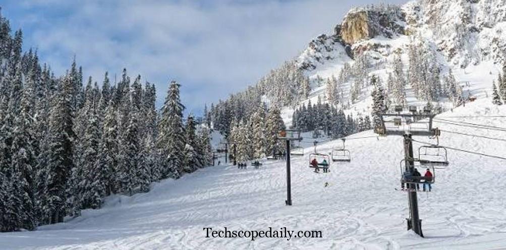
The Snoqualmie Pass webcam network is a series of live-streaming and static-image cameras maintained primarily by the Washington State Department of Transportation (WSDOT). Positioned strategically along Interstate 90, these cameras monitor road conditions, traffic flow, and weather events across the mountain pass.
Snoqualmie Pass sits at an elevation of 3,022 feet (921 meters). While it is the lowest of the three major east-west mountain routes in Washington state, it carries the highest volume of traffic. Because it serves as the main artery connecting the Puget Sound region with Eastern Washington, keeping the highway safe and clear is a massive logistical challenge.
The WSDOT camera system includes both Pan-Tilt-Zoom (PTZ) cameras that operators can move to investigate accidents, and fixed-angle cameras that provide consistent views of specific mileposts. These tools allow state troopers, snowplow drivers, and the general public to make informed, real-time decisions about highway travel.
Why Checking Live Cameras is Essential

Relying solely on your smartphone’s weather app when driving into the mountains is a dangerous gamble. Standard weather applications pull data from regional radar, which struggles to account for the unique microclimates created by deep mountain valleys and sudden elevation changes.
Here is why checking a live highway feed is absolutely critical:
- Real-Time Accumulation: Forecasts might predict one inch of snow, but a localized squall can drop six inches on the highway in less than an hour. Cameras show you exactly how much snow is on the asphalt.
- Traffic Backups: Accidents frequently close the pass. A webcam will reveal if traffic is moving smoothly or if miles of semi-trucks are parked on the shoulder waiting for a wreck to clear.
- Avalanche Control: During heavy winter storms, WSDOT regularly closes the pass for avalanche control. Cameras help you verify if the gates are open or closed.
- Visualizing the Freeze Line: You can watch the cameras to see exactly where the rain turns into freezing rain, and where the freezing rain transitions into heavy snow.
Key Camera Locations on Interstate 90
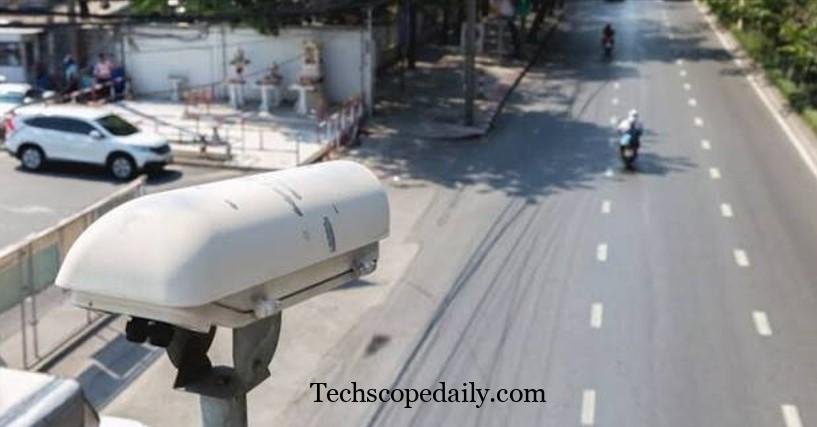
To get a complete picture of your journey, you cannot just look at one camera. You need to view the route chronologically. Here are the most important mileposts to check before you depart:
Milepost 47: Denny Creek
Located on the western approach, this camera shows you the conditions right before the steepest part of the climb. If traffic is backing up here, it usually means there is an accident or chain-up requirement further up the mountain.
Milepost 52: Snoqualmie Summit
This is the highest point of the pass and generally features the most severe weather. The Summit camera gives you a clear view of the WSDOT shed and the main overpass. If the road is bare and wet here, the rest of the pass is likely clear. If it is covered in deep, unplowed snow, prepare for a slow, white-knuckle drive.
Milepost 54: Hyak
Located just east of the summit, the Hyak camera is crucial for monitoring eastern descents. This area is notorious for high winds and blowing snow, which can severely reduce visibility even when precipitation has stopped.
Milepost 62: Stampede Pass / Price Creek
As you descend further east, the climate shifts rapidly. The Price Creek camera helps you determine if the snow is transitioning back into rain or if cold eastern winds are freezing the wet roads into dangerous sheets of black ice.
Milepost 70: Easton
Easton is a common location for chain-up and chain-off areas. Checking this camera lets you know if you are clear of the severe weather zone or if you need to keep your traction devices on for a few more miles.
How to Read Live Highway Feeds Like a Pro
Looking at a grainy image of a dark highway requires a bit of practiced interpretation. Experienced mountain drivers look for specific visual cues to determine the safety of the road.
Analyze the Pavement Reflection
During daytime viewing, look at the glare on the road. A dull, matte gray surface usually indicates dry pavement or heavily sanded snow. A high-gloss, shiny surface indicates water. If the temperature gauge on the WSDOT site reads below 32°F (0°C), that shiny surface is likely black ice.
Check the Shoulders and Barriers
Look at the concrete Jersey barriers on the sides of the highway. If they are heavily coated in white, it means the snow plows have been active. If the snow on the shoulder is encroaching into the right lane, it indicates that the snowfall is currently outpacing the plows.
Observe the Tire Tracks
If you see two distinct, dark tire tracks cutting through white snow, traffic is moving, but the road is slushy. If the tire tracks are completely white, the snow is compacting into ice, making the road incredibly slick.
Nighttime Visibility
At night, evaluate the headlights and taillights. If the lights appear heavily blurred or surrounded by halos, dense fog or heavy snowfall is actively reducing visibility.
WSDOT Restrictions: Traction Tires and Chains
When you view the live feeds on the WSDOT portal, you will often see flashing warning signs detailing current legal requirements. Washington State enforces strict traction laws during winter months. Failing to obey these rules can result in a $500 penalty and cause massive traffic jams.
Traction Tires Advised
This is the lowest level of warning. It means the road is slick, and drivers should proceed with caution. Oversize loads may be restricted.
Traction Tires Required
When this alert is active, passenger vehicles must have approved traction tires. These are tires marked with the Mountain/Snowflake symbol or Mud and Snow (M+S) designation, possessing at least an eighth of an inch of tread.
Chains Required (Except AWD/4WD)
Under this restriction, all two-wheel-drive vehicles must install tire chains. All-Wheel Drive (AWD) and Four-Wheel Drive (4WD) vehicles are exempt from chaining up at this stage, but they must carry chains inside the vehicle.
Chains Required on ALL Vehicles
This is the most severe restriction before a total highway closure. When you see this on the webcam portal, it means conditions are incredibly treacherous. Even Subarus, Jeeps, and heavy-duty trucks must install chains to proceed.
Using Webcams for Skiing and Snowboarding
Interstate 90 is not just a thoroughfare; it is the gateway to The Summit at Snoqualmie, one of the most popular winter recreation areas in the Pacific Northwest. Skiers and snowboarders rely on a different set of cameras to plan their powder days.
While WSDOT cameras point at the asphalt, the ski resort maintains a separate network of high-definition webcams pointing at the slopes, chairlifts, and parking lots.
Summit West and Central
These cameras are excellent for checking crowd sizes. If you look at the base area feeds at 8:00 AM on a Saturday and the lift lines are already sprawling, you know to expect heavy crowds.
Alpental
Alpental is known for its steep, challenging terrain. The cameras here are vital for checking visibility. Alpental is prone to dense fog banks. A quick check of the upper mountain camera can tell you if you will be skiing in the sunshine above the clouds or navigating through pea-soup fog.
Snow Stakes
The most popular webcam for winter sports enthusiasts is the snow stake camera. This is a live feed of a measuring stick placed in a secure, un-groomed area. It provides indisputable visual evidence of exactly how much fresh snow has fallen overnight, bypassing exaggerated marketing reports.
Snoqualmie Pass Webcams vs. Weather Apps
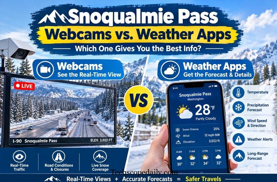
Understanding the difference between raw visual data and algorithmic forecasting is key to safe mountain travel.
| Feature | Live Webcams | Weather Applications |
| Data Type | Real-time visual confirmation | Algorithmic forecasting models |
| Accuracy | 100% accurate to the current moment | Prone to geographical errors in mountains |
| Traffic Data | Shows live backups and accidents | Only shows generic red/yellow flow lines |
| Microclimates | Captures hyper-local weather events | Often averages data over large regions |
| Snow Totals | Shows exact accumulation on pavement | Predicts potential future accumulation |
| Best Used For | Immediate go/no-go driving decisions | Planning trips 3 to 7 days in advance |
Pros and Cons of Relying on Highway Cameras
No system is perfect. While live highway feeds are invaluable tools, they come with distinct advantages and limitations that every driver should understand.
Pros:
- Immediate Ground Truth: Eliminates guesswork. You see exactly what the snowplow driver sees.
- Safety Planning: Allows you to time your departure to avoid peak storms or massive traffic closures.
- Financial Savings: Prevents you from burning fuel while idling in a three-hour traffic jam.
- Free and Accessible: Provided at no cost by the state transportation department.
Cons:
- Maintenance Outages: Severe weather—the exact time you need the cameras most—frequently knocks out power or internet connectivity to the cameras.
- Lens Obstruction: Heavy snow, ice buildup, or road spray from passing semi-trucks can blur the camera lens, rendering the image useless.
- Nighttime Limitations: Unless the camera is positioned directly under a bright highway streetlamp, nighttime visibility is extremely limited.
- Snapshot Delays: Some cameras are not true live-streaming video; they refresh a static image every 3 to 5 minutes.
What to Do When the Cameras Go Offline
During extreme blizzards or intense windstorms, the remote cameras at the summit frequently lose connection. If you cannot access the live feeds, you must rely on backup information sources before driving up the pass.
- Check the WSDOT X (Twitter) Account: The @WSDOT_Passes account is managed by human operators who post constant, minute-by-minute text updates about closures, wrecks, and chain requirements.
- Tune into Highway Advisory Radio: As you approach the foothills, tune your car radio to 1610 AM. The state broadcasts recorded, looping updates regarding pass conditions and pass closures.
- Check the Electronic Message Boards: WSDOT utilizes massive overhead LED signs spanning the highway miles before the pass begins. Never ignore these signs. If they say “Chains Required Ahead,” pull over at the designated safe zones and put them on.
Essential Vehicle Preparation for the Pass
Looking at a clear webcam image and assuming the drive will be effortless is a common rookie mistake. Mountain weather can deteriorate from clear skies to a whiteout blizzard in less than twenty minutes. Even if the cameras show bare pavement when you leave your house, you must prepare your vehicle for the worst-case scenario.
- Practice with Your Chains: Never buy a set of tire chains and leave them in the box. Practice installing them in your dry driveway. Trying to figure out complex chain links on the side of a freezing highway while semi-trucks blast you with slush is dangerous and frustrating.
- Pack a Winter Survival Kit: Your trunk should contain heavy wool blankets, extra waterproof gloves, high-calorie non-perishable snacks, and a few bottles of water.
- Bring a Real Snow Shovel: A plastic ice scraper will not help you if the snowplow accidentally buries your car in a berm while you are parked at the ski resort. Keep a compact, metal avalanche shovel in your vehicle.
- Top Off Your Fluids: Ensure your gas tank is completely full before you begin ascending the mountain. Fill your windshield wiper reservoir with winter-grade fluid rated for sub-zero temperatures to prevent it from freezing to your glass.
Frequently Asked Questions (FAQs)
1. How often do the Snoqualmie Pass webcams update?
Most WSDOT cameras provide live streaming video. However, during high-traffic periods or in areas with limited bandwidth, some cameras revert to static images that refresh every 2 to 5 minutes.
2. Where is the best place to view the official cameras?
The most reliable source is the official Washington State Department of Transportation (WSDOT) website or their official mobile application. Third-party sites often scrape this data, which can result in delayed images.
3. Do highway cameras work in the dark?
Yes, but effectiveness varies. Cameras located near interchanges (like Hyak or Easton) benefit from overhead streetlights. Cameras in remote stretches only show the headlights of passing cars and are heavily degraded by darkness.
4. What does “Avalanche Control” mean on the WSDOT alerts?
Avalanche control means the state has intentionally closed the highway to trigger controlled landslides using explosives. This clears unstable snowpack to prevent natural avalanches from burying moving traffic. These closures typically last 1 to 2 hours.
5. Why are the pass cameras sometimes unavailable?
The cameras are located in extreme alpine environments. High-speed winds, heavy ice accumulation, and falling trees frequently sever power lines or internet cables, temporarily taking the system offline.
6. Are there specific webcams for the ski resort?
Yes. The Summit at Snoqualmie maintains its own proprietary network of high-definition webcams pointing at chairlifts, terrain parks, and parking lots. These are separate from the WSDOT traffic cameras.
7. Is Snoqualmie Pass dangerous to drive in the winter?
It can be. While it is a wide, well-maintained interstate, the combination of high elevation, rapid temperature drops, and heavy traffic volume creates hazardous conditions. Driving at safe speeds and using proper traction tires mitigates the vast majority of the danger.
8. What is the actual elevation of Snoqualmie Pass?
The summit sits at 3,022 feet (921 meters) above sea level. This is the lowest of Washington’s Cascade passes, which is why it remains open year-round (except during major snow clearing operations).
9. Can I view the cameras on my smartphone while driving?
You can view them on the WSDOT mobile app, but it is highly illegal and incredibly dangerous for the driver to check a phone while operating a vehicle. Always have a passenger check the app, or pull over to a safe rest area to view the cameras yourself.
10. Do I really need chains if I have All-Wheel Drive (AWD)?
Yes. While AWD vehicles are often exempt from the initial chain requirements, Washington state law dictates that all vehicles entering the pass during winter conditions must physically carry chains inside the car, just in case conditions escalate to “Chains Required on ALL Vehicles.”
Conclusion
Mastering the Snoqualmie Pass webcam system is a non-negotiable skill for anyone traveling across Washington State during the winter months. By learning how to locate the right cameras, interpret the visual data on the road surface, and combine that knowledge with official WSDOT travel alerts, you take control of your own safety.
Never let a sunny departure point lull you into a false sense of security. The Cascade Mountains generate their own weather, and conditions at the 3,000-foot summit can change in the blink of an eye. Check the live feeds, obey the traction tire laws, pack your emergency supplies, and drive according to the visual conditions on the pavement. Preparedness is the ultimate key to a safe and stress-free journey over the pass.


